Field mapping

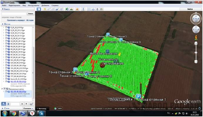
“Field mapping” function allows to show the sowing on navigator’s monitor and then on PC display with electronic media (Google Earth program).
Farm operator has a possibility to analyze the sowing campaign based on the information available:
-
tractor’s direction
-
acreage planted
-
seeder’s stops
-
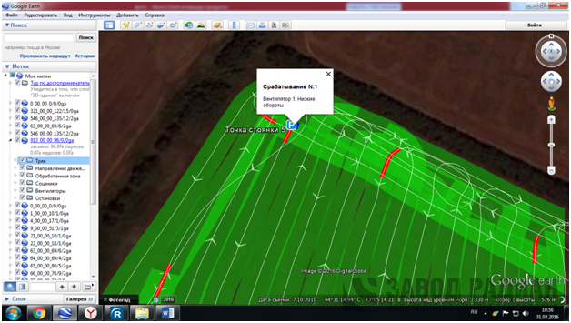
numbers of clogged coulters
-
ustable sowing distance
-
vent’s low rotary speed
-
availability of seeds in the feeders
-
tractor’s speed

Submit your application
Fill out the form and we will call you back:
You recently watched